
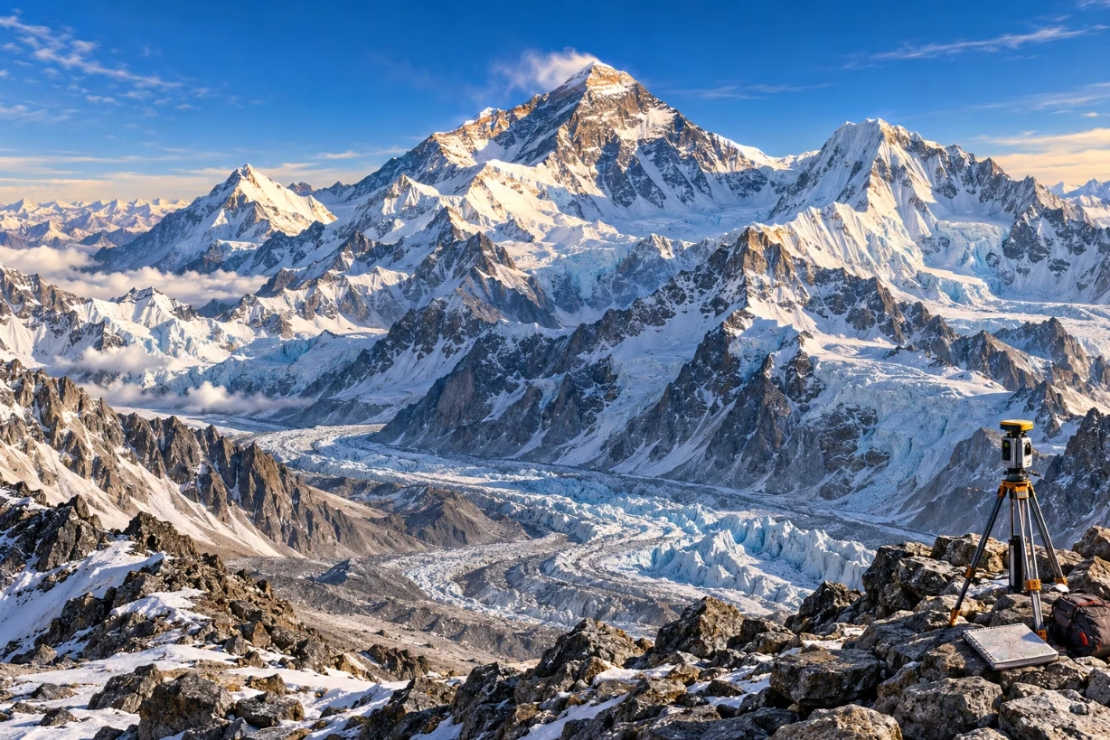
The official height of Mount Everest mountain is now 8,848.86 meters, or 29,031.7 feet, above sea level. This latest figure comes from a joint survey by China and Nepal, and it slightly updates the older, widely known height of 8,848 meters or 29,029 feet.
When I first read about the height of Mount Everest mountain as a kid, the number 29,029 feet felt almost magical. Teachers wrote it on the board. Books printed it in bold. It seemed like a fixed truth. Years later, I learned that even the tallest mountain on Earth is part of a moving, shifting planet, and its height has been measured, recalculated, and even argued over for more than 170 years.
Why The Official Height Of Mount Everest Mountain Keeps Changing
The height of Mount Everest mountain sounds like it should be simple. Measure from sea level up to the summit and you are done. In reality, it is much more complex. Sea level is not the same everywhere, the Earth is not a perfect sphere, the mountain is still rising because of plate movement, and snow and ice on the top can change from year to year.
Mount Everest sits on the border between Nepal and the Tibet Autonomous Region of China, in the Himalayas. It rises above 8,800 meters, so even a small error in measurement can mean several feet of difference. Over time, science tools get better, mapping systems get more accurate, and new agreements between countries lead to updated numbers.
The most recent change came when Nepal and China worked together and announced a shared, official height in 2020: 8,848.86 meters, or 29,031.7 feet. That joint result settled years of small disputes and gave the world a common figure for the height of Mount Everest mountain.
Key Official Measurements Of Mount Everest Over Time
To really understand the history of the height of Mount Everest mountain, I find it helpful to look at the main milestones. These numbers are not random. Each one reflects the best tools and methods of its time.
The Great Trigonometrical Survey And The First Big Number
The first famous measurement came from the Great Trigonometrical Survey of India in the 19th century. British surveyors spent years in the field, using long chains, theodolites (precision sighting tools), and complex math to measure distances and angles across rough land and high hills.
They could not even go into Nepal at first, so they measured from far away in India. By looking at the angle from several points and doing trigonometry, they could estimate the height. Around the 1850s, they came up with a height of about 8,840 meters, and later refined it to 8,848 meters, which is 29,029 feet. For more than a century, that number became almost sacred in geography books, and it defined the height of Mount Everest mountain for the whole world.
Modern Surveys, GPS, And 8,848 Meters
As technology improved, scientists and survey departments went back to the mountain with better tools. Radar, satellite images, and then GPS receivers helped refine the height.
For many years in the late 20th century, 8,848 meters (29,029 feet) was still used as the official height. Nepal used that number as its standard. Many maps and atlases printed it. Climbers grew up with it. Even as new methods arrived, the change was small enough that most people just kept saying 29,029 feet when talking about the height of Mount Everest mountain.
The Chinese Measurement And A Rock-Only Debate
China carried out its own surveys from the Tibetan side. At one point, Chinese survey teams announced a height focused on the rock summit itself, not including the thick ice and snow layer on top. That rock-only number was slightly lower than the full height including snow.
This raised a slow, technical debate. Should the “true” height of Mount Everest mountain measure to the top of the rock or to the highest point of snow and ice? Different countries and scientific groups had different traditions. Some focused on the snow cap, because that is what you actually stand on at the summit. Others preferred the stable rock point below the ice, which does not melt or blow away.
The 2020 Joint Announcement: 8,848.86 Meters
After years of discussion, Nepal decided to run its own full survey of the height of Mount Everest mountain. Nepalese teams climbed the mountain with modern GPS units, radar depth devices to measure snow depth, and links to satellite systems for better accuracy. China did a similar survey from its side.
In 2020, the two countries made a joint announcement. They agreed that the official height of Mount Everest mountain is 8,848.86 meters, which converts to about 29,031.7 feet. That means the famous 29,029 feet value was slightly low, by a couple of feet. The difference is tiny if you imagine standing on the peak, but for science, mapping, and national pride, it matters.
How Surveyors Actually Measure The Height Of Mount Everest Mountain
When I look at the history of Everest, the most interesting part for me is not just the number, but how people manage to get that number at all. Measuring the height of Mount Everest mountain mixes classic geometry with cutting-edge space tech.
Traditional Trigonometry From The Ground
The oldest method uses trigonometry. Surveyors pick a point at a known distance from the mountain. They measure the angle from that point up to the summit. With that angle and the horizontal distance, they can calculate the height using basic trig formulas.
To improve accuracy, they measure from many different points at different distances. They also need to correct for the curvature of the Earth, refraction of light in the air, and small errors in instruments. This method gave the first reliable estimates of the height of Mount Everest mountain in the 1800s.
Leveling From Sea Level
To say that Everest is a certain height “above sea level,” you need a very clear sense of what sea level actually is. Surveyors run a network of “benchmarks,” or reference points, from a known tide-gauge station near the coast, all the way inland toward the mountain, using leveling instruments.
Over long distances, they combine precise leveling with gravity data and models of the Earth’s shape to define a reference surface called the geoid. This is a kind of “shape of global sea level” if the oceans were calm and could flow everywhere under the continents. The height of Mount Everest mountain is then measured above that curved reference surface, not a flat line.
GPS And GNSS On The Summit
The biggest jump forward came from satellite-based positioning. Survey teams now carry GPS or GNSS (Global Navigation Satellite System) receivers to the top of Everest. These receivers pick up signals from satellites that orbit the planet and use them to calculate the exact position of the summit in three dimensions.
Because those raw satellite heights are relative to a mathematical Earth shape called an ellipsoid, scientists still need to convert them to a height above the geoid (which relates to global sea level). They also account for tectonic plate motion and local gravity. When all those steps are done, the final result becomes the updated height of Mount Everest mountain.
Measuring The Snow And Ice Depth On Top
On top of the rock at the summit, there is usually a layer of ice and snow. That layer can be thick, thin, hard, soft, or packed by wind. To get a full picture, survey teams use ground-penetrating radar or other tools to measure how much of the highest point is snow and how much is rock.
In some recent surveys, climbers drilled or placed equipment directly into the ice and then measured the depth to rock. This makes it possible to report both a rock height and an ice height. The official height of Mount Everest mountain usually refers to the highest snow point, but the rock number stays in the background as a reference.
Why Different Sources Still Show Different Heights
If you search online, you might still see at least three numbers for the height of Mount Everest mountain: 8,848 meters, 8,850 meters, or 8,848.86 meters. That can feel confusing, but it does not mean anyone is wildly wrong.
Some maps are old, printed before the 2020 joint announcement, and simply have not been updated. Some sources round the exact 8,848.86 meters to 8,849 meters or round 29,031.7 feet to 29,032 feet. In casual writing, many people still use 29,029 feet out of habit, because that number lived in school textbooks for generations.
On top of that, scientists sometimes publish both rock height and snow height, so depending on which one a writer picks, you might see a small change in the value used for the height of Mount Everest mountain. From a climber’s point of view, a two- or three-foot difference does not change the challenge, but for survey science, every centimeter is part of the story.
How Plate Tectonics Affects The Height Of Mount Everest Mountain
Mount Everest was born when the Indian plate slammed into the Eurasian plate millions of years ago. That collision is still happening. The Himalayas are basically a slow-motion crash zone, squeezing rock upward over time.
Because of this, the height of Mount Everest mountain is not fixed forever. GPS and geological studies show that the Himalayas are rising at a small rate, often talked about in millimeters per year. Earthquakes sometimes shift the land up or down by a few centimeters, and some scientists think large quakes can slightly adjust the height of big peaks, including Everest.
That does not mean that one day you will wake up and Everest will be thousands of feet taller. These changes are slow and subtle. But if surveyors measure the mountain accurately every few decades, they may see a small but real trend, which keeps the story of the height of Mount Everest mountain alive and evolving.
Weather, Climate, And The Summit Snow Cap
When climbers describe the summit of Everest, they talk about brutal cold, fierce wind, thin air, and a blinding white cap of snow. That snow is part of what defines the real, day-to-day height of Mount Everest mountain, because climbers stand on that frozen surface.
Snow depth can change with storms, seasonal patterns, long-term climate shifts, and strong summit winds that move snow from one side of the ridge to another. Some expedition reports say that in certain years the rocky summit “step” feels more exposed, which hints that the snow layer might be thinner at times.
Climate change may also affect glaciers and snow patterns around Everest. Glaciers below the summit are retreating in many parts of the Himalayas. If snow at the very top thinned out over many years, future surveys could notice a small change in the measured ice height, even if the rock base of the summit stays the same. All of this shapes the practical sense of the height of Mount Everest mountain that climbers see and feel.
Mount Everest Compared To Other Tall Mountains
Whenever I talk about the height of Mount Everest mountain, people often ask how it compares to other famous peaks. The answer depends on what you count as “tallest.”
By elevation above sea level, Everest is number one. No other mountain has a summit higher than its 8,848.86 meters. K2, the second-highest peak, is about 8,611 meters, or 28,251 feet, which makes it slightly lower but often more technically dangerous to climb.
If you measure from base to summit, some argue that Mauna Kea in Hawaii is taller, because so much of it lies under the ocean. If you measure from the center of the Earth outward, some peaks in the Andes around the equator stand farther out, because the Earth bulges at the equator. But in normal, everyday use, when people talk about the tallest mountain in the world, they mean the height of Mount Everest mountain above sea level.
Why The Height Of Mount Everest Mountain Matters So Much
On one level, the fuss over a few extra feet might seem strange. But the exact height of Mount Everest mountain matters for several reasons, both emotional and practical.
A Symbol Of Human Curiosity And Effort
Everest has always been a symbol of limits and challenges. Long before climbers reached the top, surveyors struggled to measure it. They carried heavy instruments across deserts, jungles, and high plains. They battled sickness, political barriers, and extreme weather, just to get a better handle on one number.
To me, that repeated effort shows how deeply humans care about knowing our planet. Each time the height of Mount Everest mountain is updated, it reflects years of field work, calculations, and quiet patience behind the scenes.
National Identity And Cooperation
For Nepal and China, Everest is more than a point on a map. It is part of national identity, tourism, and history. When two neighboring countries agree on a common number, harmonize their data, and share the result with the world, it sends a signal of cooperation.
The joint 2020 announcement turned the height of Mount Everest mountain into a shared fact. That shared fact supports mapping projects, rescue planning, climbing permits, and scientific research. It also reduces needless confusion in textbooks, guidebooks, and media.
Better Maps, Navigation, And Science
Accurate heights matter for more than just records. They tie into climate models, satellite calibration, flight navigation, and global geodetic networks. When you refine the height of Mount Everest mountain, you often improve the whole reference system that underpins maps and GPS services across a large part of Asia.
Modern satellites and mapping platforms use known heights of certain peaks as checks to confirm that their data is aligned with the real world. In a way, Everest serves as a giant, natural benchmark, standing above the clouds to help fine-tune the tools we all rely on for directions and geographic information.
Quick Facts About The Height Of Mount Everest Mountain
To pull things together, here are some fast, helpful facts about the height of Mount Everest mountain and its key details:
- Official current height: 8,848.86 meters or 29,031.7 feet.
- Location: Border of Nepal and Tibet in the Himalayas.
- Most famous older figure: 8,848 meters or 29,029 feet.
- First major survey: Great Trigonometrical Survey of India in the 19th century.
- Named after: Sir George Everest, a British surveyor-general of India.
- Measured using: Trigonometry, leveling, GPS/GNSS, gravity models, and radar for snow depth.
- Still rising slowly due to plate tectonics, with minor changes over long periods.
Even though this list is compact, each line holds a deep story of science, geography, and human will. The height of Mount Everest mountain is not just a dry data point. It sits at the crossing of history, climate, technology, and the human love of high places.
What The Future May Hold For Everest’s Official Height
Looking ahead, I expect the official height of Mount Everest mountain will be checked and updated again. As satellite tech improves and new gravity data become available, scientists will likely run more detailed models of the Earth’s surface and the geoid. Climbers may carry even more advanced sensors to the summit.
Future surveys might tweak the height by a few centimeters or a few inches. That has already happened before, and it will happen again. Instead of seeing those tweaks as confusion, I see them as proof that our view of the world can still get sharper.
What will probably not change is Everest’s place in people’s minds. Even if the number shifts from 8,848.86 to something slightly different, the height of Mount Everest mountain will remain a shared reference point, a goal for climbers, and a quiet challenge for surveyors with their instruments and equations.
When someone asks how tall the highest mountain on Earth is, I now answer with a bit more nuance. I say that the official height of Mount Everest mountain is 8,848.86 meters, explain that this reflects a joint effort by Nepal and China using modern methods, and add that the mountain, the plates beneath it, and the snow on top keep moving, very slowly, as our planet breathes and shifts over time.
Conclusion: The Living Number At The Top Of The World
The height of Mount Everest mountain may look like a fixed number in a table, but behind it lives a story of careful measurement, national pride, and human persistence. From the early trigonometrical surveyors with brass instruments to today’s GPS-equipped climbers, generations of people have tried to answer one simple question: how high is this peak above the sea that circles our world.
Right now, the best answer we have is 8,848.86 meters, or 29,031.7 feet, above sea level. That value is precise, tested, and shared between the two countries that guard the mountain’s sides. At the same time, I know that the height of Mount Everest mountain is part of a living Earth. The rock still rises slowly, the snow still shifts, and our tools still improve. In that sense, the number at the top of the world is both a fact and a work in progress, reminding us that even the highest point on the planet is part of an ongoing story.